Exploring the Potomac Highlands region
More Info abandonedonline.net
Driving through the backroads and camping in the Potomac Highlands region of West Virginia during the autumn season while taking photos of abandoned houses, historic sites, covered bridges, and stunning landscapes against the backdrop of golden foliage was the most enjoyable way to experience the area.
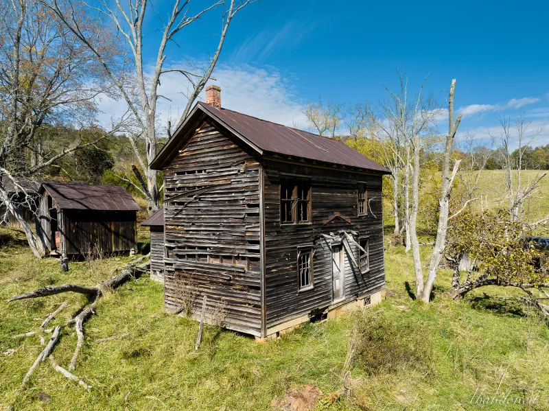
After crossing South Fork Mountain, I stumbled upon an old, wood weatherboard-sided residence in the midst of a cow pasture. Thanks to the kindness of a nearby neighbor and owner, I was able to drive onto the farm for a better look at this still-sturdy structure.
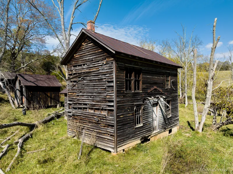
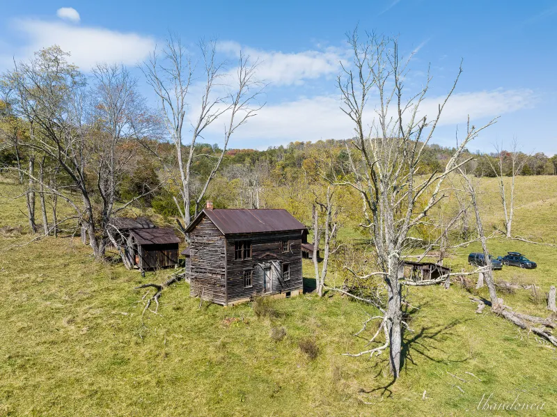
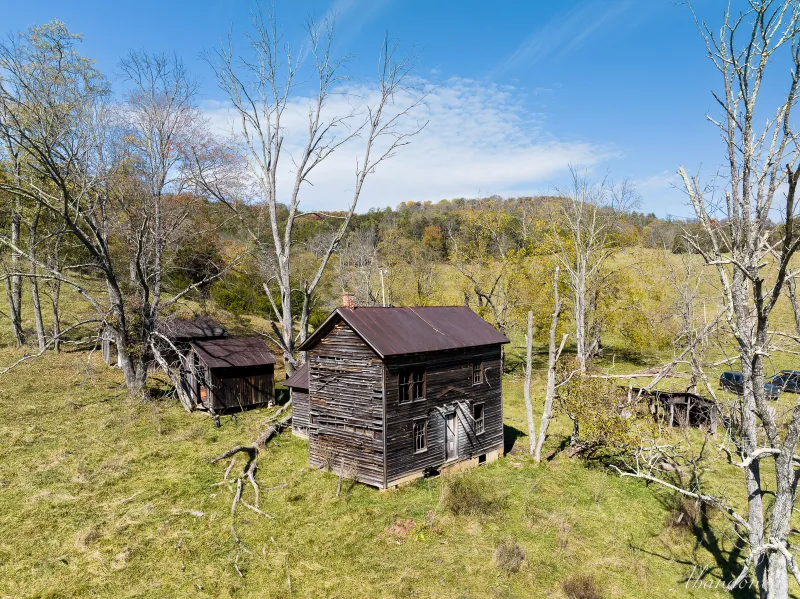
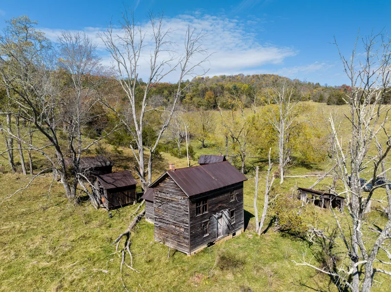
#1
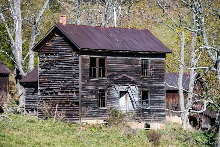
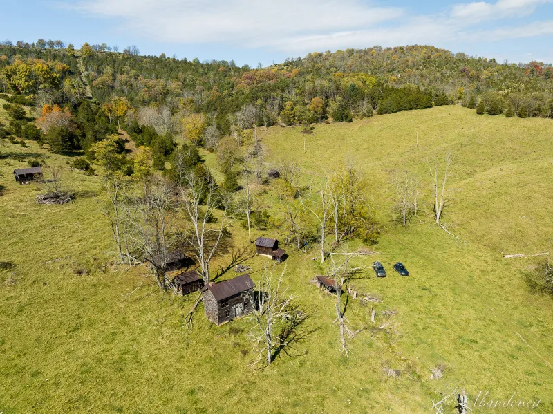
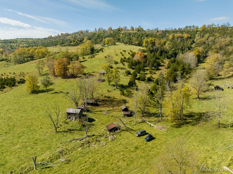
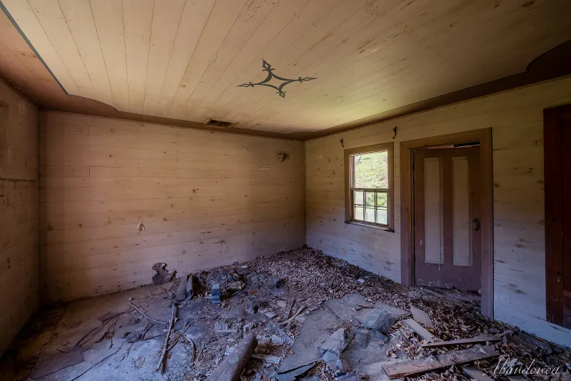
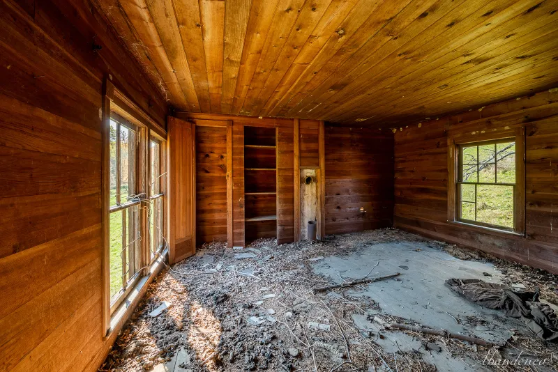
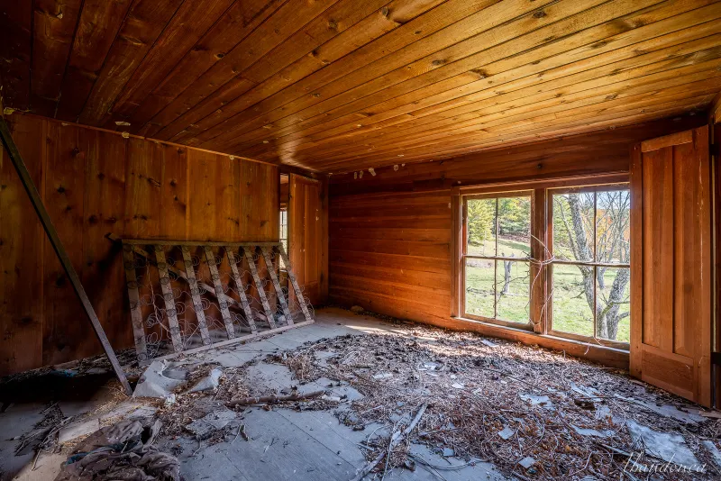
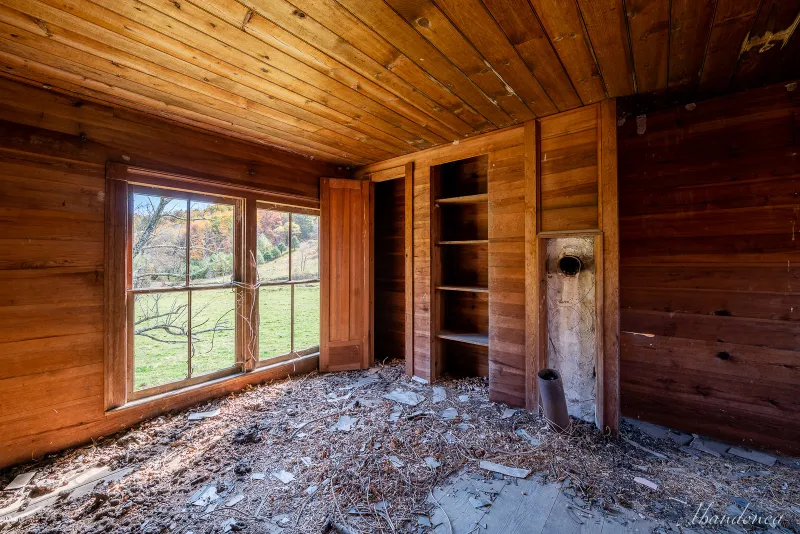
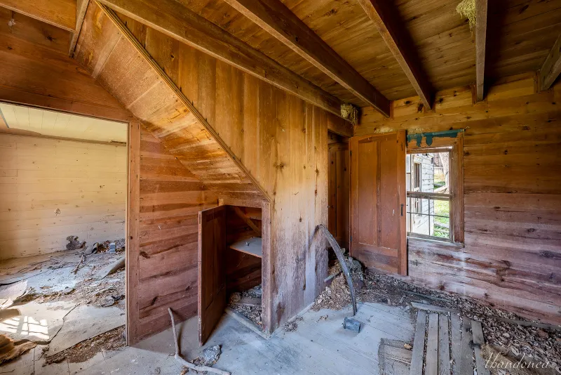
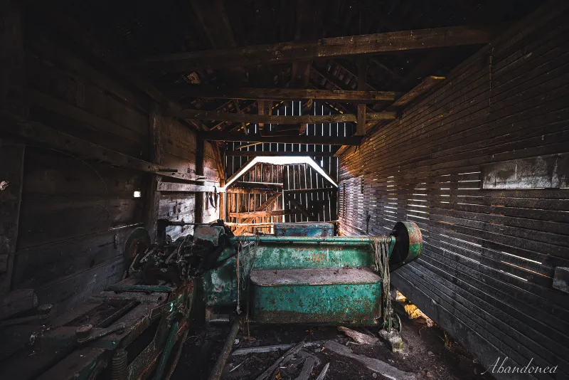
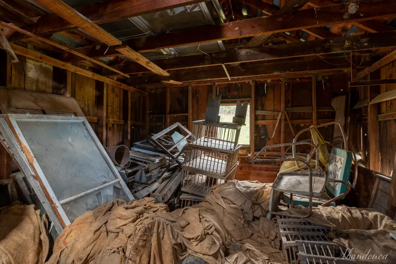
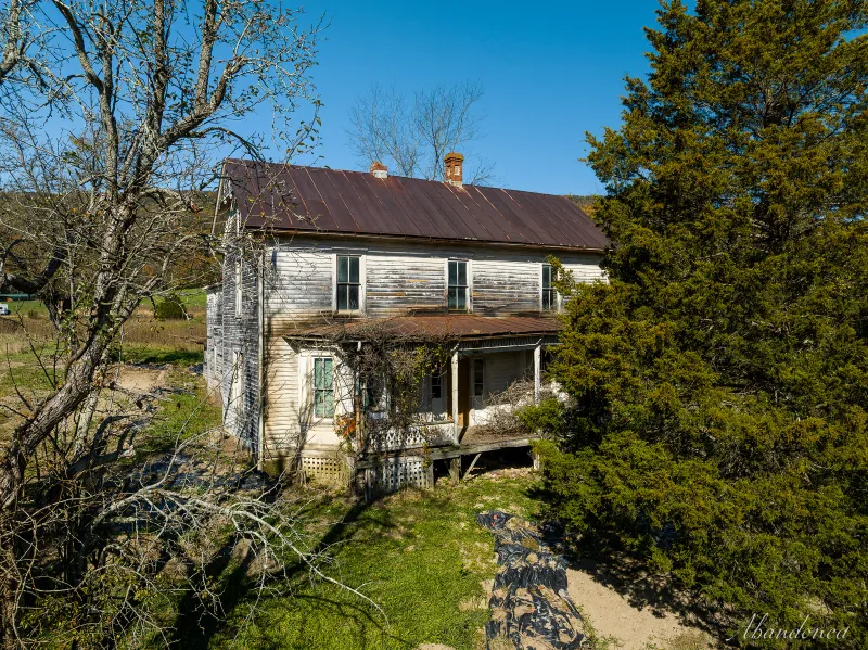
Located on approximately 75 acres of hilly terrain in the shadow of South Fork Mountain, the Simmons Farm was a self-sufficient farmstead that consisted of a variety of log and frame buildings that were built using local materials. The farmhouse, which was constructed around 1908, is a two-story, three-bay frame structure with a 1½-story rear wing, a concrete foundation, and original 2/2 and 3/3 windows. It also has a standing seam tin roof and is adorned with hand stenciling on the ceiling in the living room, which was done by the farm’s primary occupant, a local painter. The farm also includes a woodworking shop, a combination corn crib, and barn, the remains of a spring house, and an outbuilding with chicken crates. There is also a family cemetery located on the hilltop.
#2
#3
#4

#5
#6
#7
#8
#9
#10
#11

#12
#13
#14
#15
#16
#17
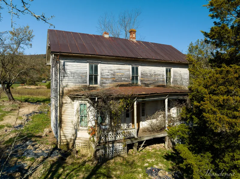
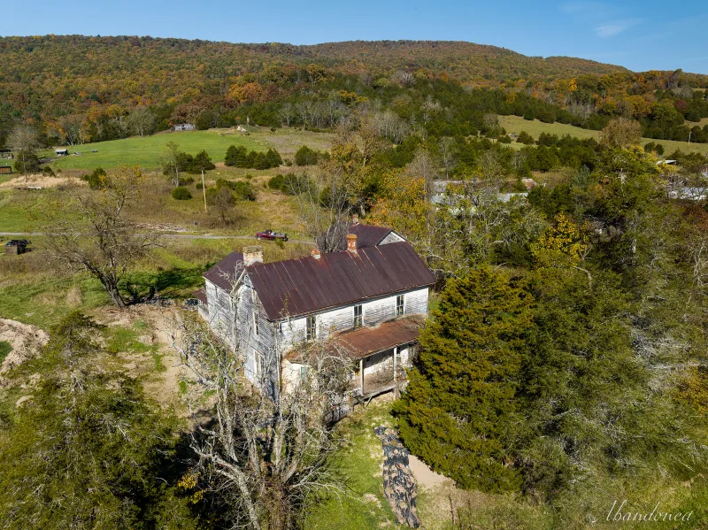
The William C. Miller Home, located over the hill, was constructed on the location of Fort Seybert in the 1890s. Although the house itself may not be particularly significant, the fort had historical significance due to the surprise attack by Shawnee and Delaware warriors on April 28, 1758. During this attack, thirty white settlers were killed as they were left practically defenseless as several men had gone to the Shenandoah Mountains for business.
In Virginia, Fort Seybert was one of the 23 frontier forts that were constructed along the western frontier.
The Miller family farmed the land around 1800 and built the two-story house on the property. Around the turn of the century, an addition was added to the front of the house. In 1915, delicate fan ornamentation with pendants was added to the gable ends, along with tall 2/2 windows, a wide porch, and a standing seam tin roof. These features, combined with its commanding presence above the roadway, make the residence stand out.
#18
#19
#20
The South Branch valley’s “upper tract” was surveyed in the early 18th century, around 1750. Later, a large influx of European immigrants moved into the region and settled in the valley and along the forested ridgelines. One of these immigrants was Samuel Kline, who was from Germany and arrived before 1861. He served as postmaster for a community located at Greenawalt Gap, along Mill Run. The community eventually adopted Kline’s name, first being called Klines Cross Roads and then shortened to just Kline, sometime around 1875.
While exploring the region about ten years ago, I stumbled upon one of the more interesting structures at Kline: the old hotel and general store. The clapboard-sided two-story building boasts a broad front-facing porch, numerous 2/2 windows, dormers, and a traditional standing seam tin roof.
The unique architecture in this region, exemplified by a house constructed in 1904 with a blend of Queen Anne and vernacular styles, is equally as interesting as the other features of the area. The house has original wood clapboard siding, decorative trim, replacement windows and doors, and a broad parapet. Though I initially thought the parapet was not original, there are three other nearby structures from the same time period that also feature this distinctive style.
The house was in excellent condition a decade ago, but after the owner passed away, it has become neglected and overrun with feral cats.
The old mill ruins, located at the foot of Greenawalt Gap in Mill Run, were likely damaged by the flood of 1985 and eventually collapsed.
The house is located next to a charming circa 1890 home with original wood trim, 2/2 windows, a standing seam porch, and a front porch that appears to be held up by cut trees and is in a state of decay.
Located in Kline, the former County Route 1 bridge over Mill Run was a five-panel pinned Pratt pony truss that was abandoned in 1988 when it was replaced with a modern concrete structure. Despite being relocated to an adjoining farm, the bridge was never repurposed.
There will be another post following this one.